
Crater Lake National Park, Oregon: Complete Visitor Guide
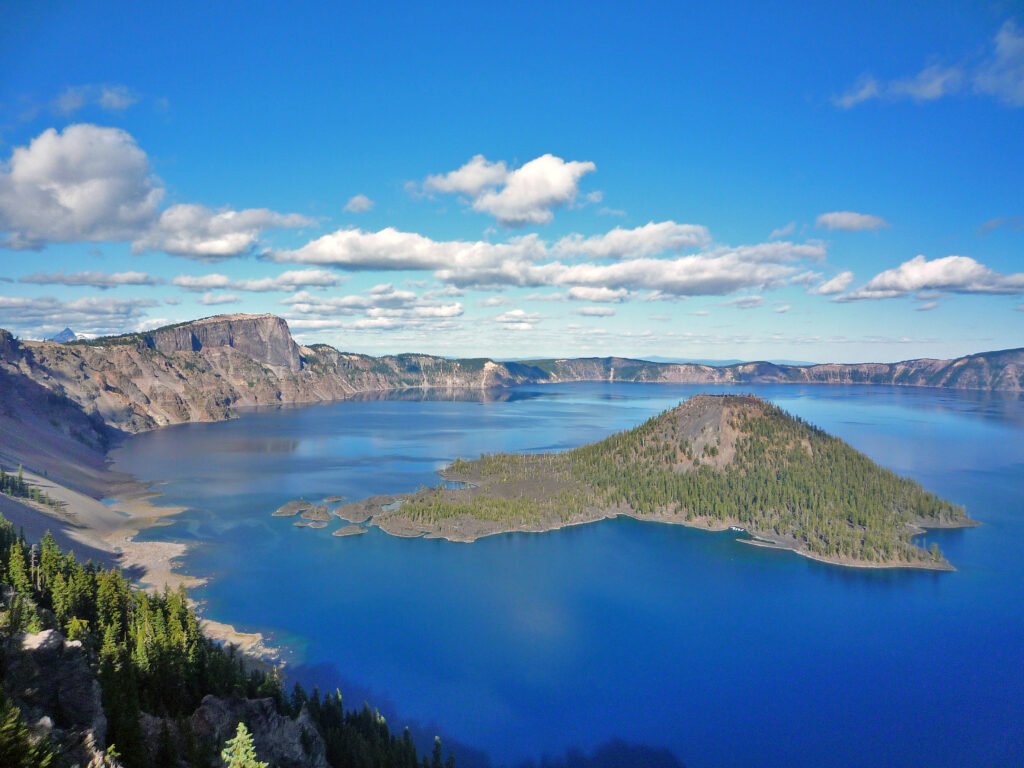
Crater Lake National Park protects the deepest lake in the United States and one of the most dramatic volcanic landscapes in North America. The lake fills the collapsed caldera of Mount Mazama, whose massive eruption about 7,700 years ago reshaped the region.
Fed almost entirely by rain and snow, Crater Lake is famous for its extraordinary blue color and steep surrounding cliffs.
Crater Lake at a glance
- Location: southern Oregon
- Best for: viewpoints, scenic driving, hiking and photography
- Main feature: deep volcanic caldera lake
- Visit length: half day to two days
Rim Drive
Rim Drive circles much of the lake and connects major overlooks, trailheads and viewpoints. When fully open, it is the easiest way to appreciate the scale of the caldera from different angles.
Heavy snowfall means portions of the road can remain closed well into the warm season, so current road status should always be checked before visiting.
Viewpoints and hiking
Rim Village and Discovery Point provide classic views, while trails such as Garfield Peak offer higher perspectives for prepared hikers.
The park’s elevation means weather can change quickly even in summer. Carry layers, sun protection and water.
Wizard Island and lake access
Wizard Island is the volcanic cone rising from the lake and one of Crater Lake’s most recognizable features. Direct access to the water is limited and depends on the status of the steep Cleetwood Cove route and boat operations.
Long-term rehabilitation work can affect lake access, so visitors should check current conditions rather than assuming boat tours are operating.
Snow and winter
Crater Lake receives enormous snowfall and is transformed for much of the year. Winter visitors can experience snowshoeing and cross-country skiing, but roads, parking and services are more limited.
Best time to visit
July through early fall usually provides the greatest road and trail access. Spring often still feels like winter, while autumn can bring early snowstorms.
Practical tips
- Check road status before driving to the park.
- Do not assume Rim Drive is fully open.
- Bring warm layers even on summer days.
- Fill up with fuel before entering remote areas.
- Allow time for several overlooks rather than stopping only at Rim Village.
Is Crater Lake worth visiting?
Absolutely. The scale, color and volcanic setting make it one of the most visually distinctive national parks in the United States.
Official information
For current roads, snow conditions, fees and closures, visit the official National Park Service website.

